Navigation
Exchange rates
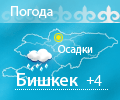
Weather
In the footsteps of Great Silk Road
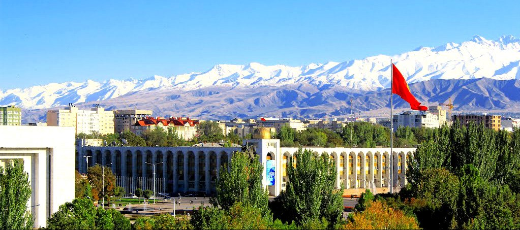
publicated: 19.12.2017Day 1. Bishkek Town - Ala-Archa National Park
Arrival in Bishkek, meeting at the airport, transfer to the hotel. Rest.
Bishkek is situated at about 800 metres (2,600 ft) altitude just off the northern fringe of the Kyrgyz Ala-Too range, an extension of the Tian Shan mountain range, which rises up to 4,855 metres (15,928 ft) and provides a spectacular backdrop to the city. North of the city, a fertile and gently undulating steppe extends far north into neighboring Kazakhstan. The Chui River drains most of the area. Bishkek is connected to the Turkestan-Siberia Railway by a spur line.
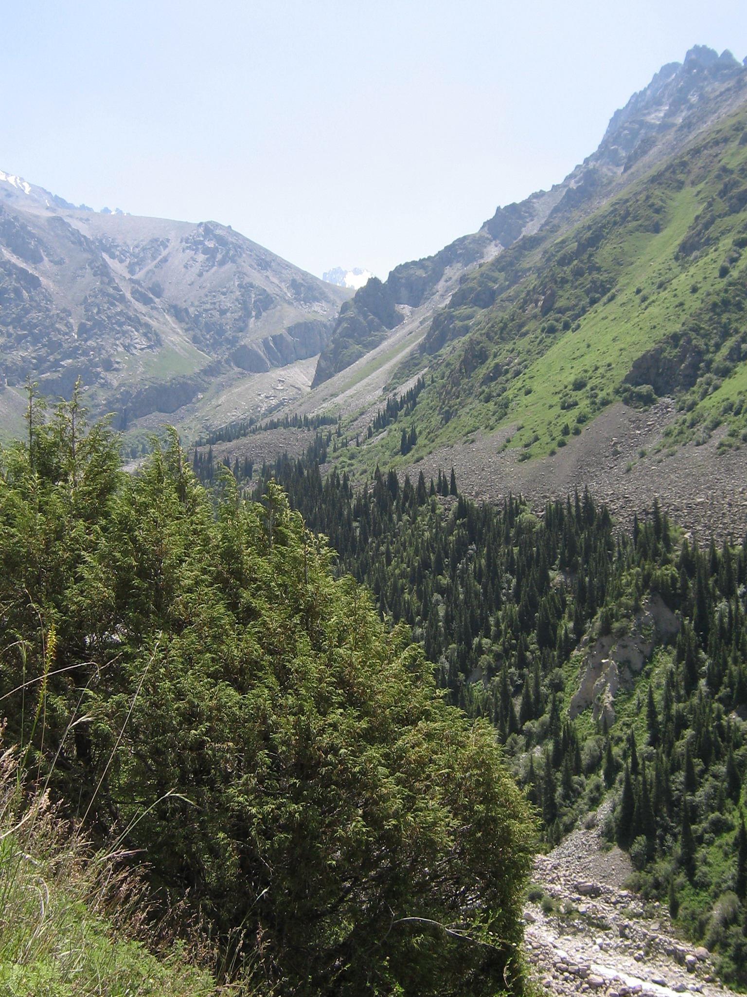
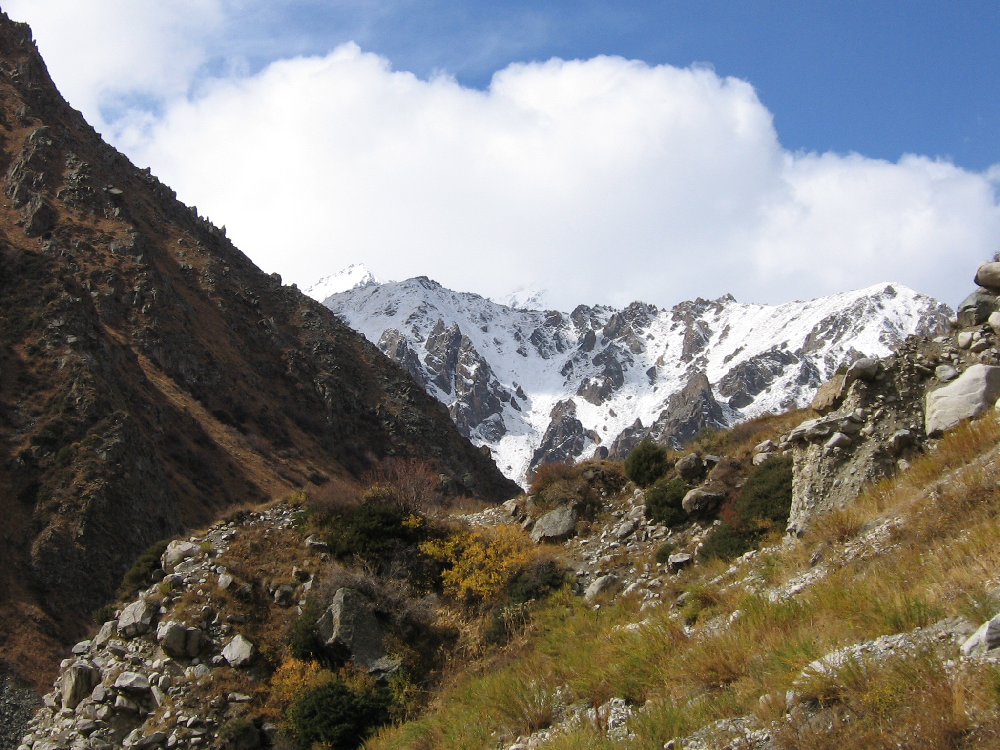
After short rest transfer to Ala-Archa National Park.
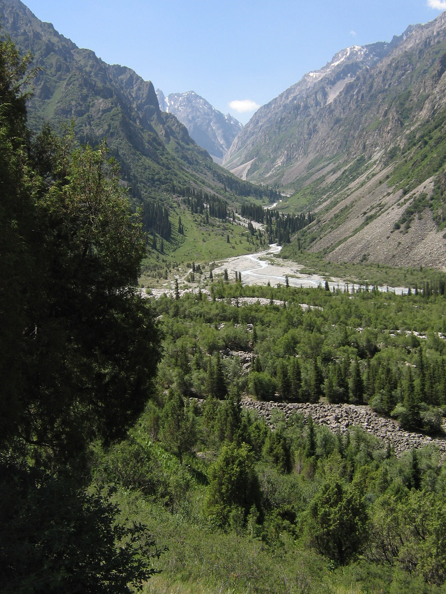
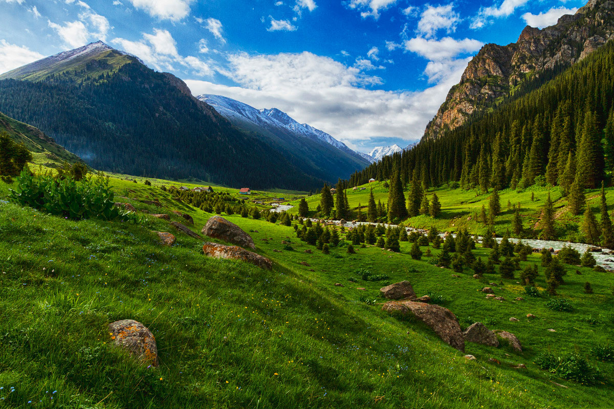
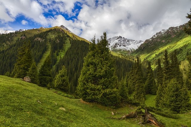
The Ala Archa National Park is an alpine National Park in the Tian Shan mountains of Kyrgyzstan, established in 1976[1] and located approximately 40 km south of the capital city of Bishkek. The park, which includes the gorge of the Ala-Archa River and the mountains surrounding it, is a popular destination point for weekend picnicers, hikers, horse trekkers,skiers as well as mountain climbers looking for challenging ice, rock and mixed routes. The park is open year round, although the most popular season is late summer and early fall.
Lunch-picnic in the territory of the park.
Walking to the waterfall or to the Alpinist cemetery.
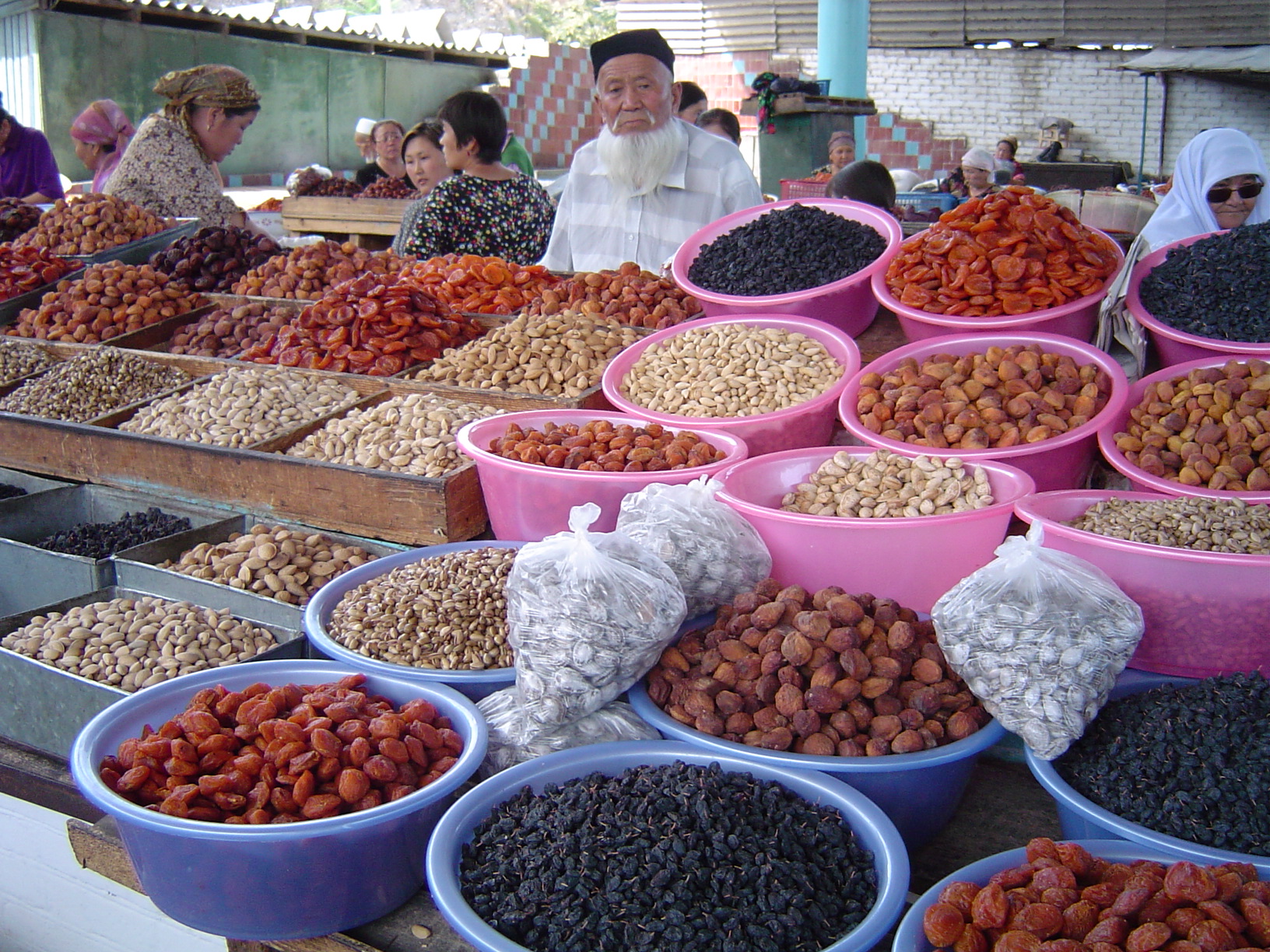
Back transfer to Bishkek, city-tour, including visiting Osh-bazaar, Central Square, Oak park, Victory Square.
Dinner in a national restaurant.
Accommodation at the hotel.
Day 2. Bishkek - Son-Kul Lake
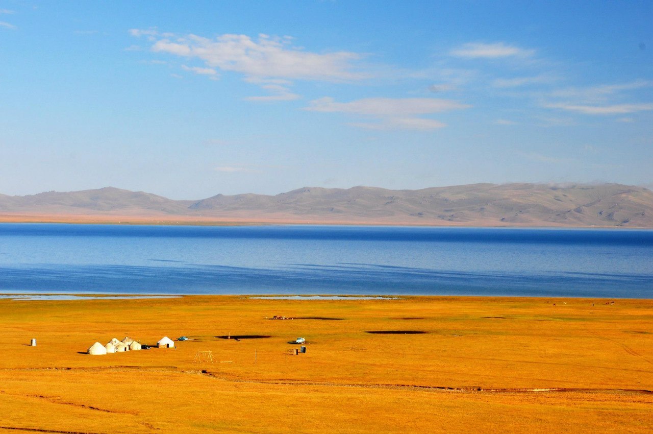
Transfer to Son-Kul Lake. Accommodation at the yurt camp.
Lunch. Free time for walking around (opportunity to rend horses).
Dinner.
Song Köl (literally "following lake") is an alpine lake in northern Naryn Province, Kyrgyzstan. It lies at an altitude of 3016 m, and has an area of about 270 km2 and volume of 2.64 km3. Lake's maximum length is 29 km, breadth about 18 km, and extreme depth f 13.2 m. It is the second largest lake after Issyk Kul Lake, and the largest fresh water lake in Kyrgyzstan. Its name, meaning "following lake", is popularly considered to refer to this relation. It is surrounded by a broad summer pasture and then mountains. Its beauty is greatly praised, but it is rather inaccessible. The best approach seems to be the 85 km road from Sary-Bulak on the main north-south highway. Other routes require 4x4s. There are no facilities on the lake, but local herders will provide supplies and rent yurts. The area is inhabited and safely accessible only from June to September.
Day 3. Son-Kul-Lake - Tash-Rabat Gorge
Transfer to Tash-Rabat Gorge.
Lunch at the local café in Naryn Town.
Accommodation at the yurt camp in Tash-Rabat Gorge.
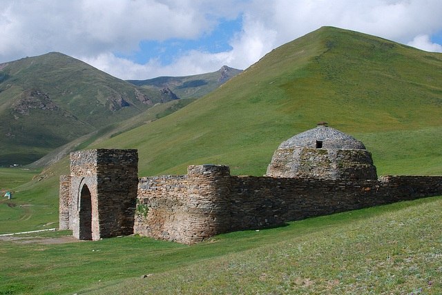
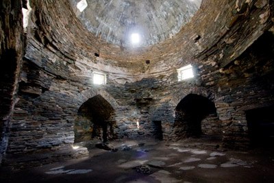
Tash Rabat is a well-preserved 15th century stone caravanserai in At Bashy district, Naryn Province, Kyrgyzstan located at the altitude of 3,200 meters. As early as in 1888, a Russian doctor and traveler Nicolay Lvovich Zeland suggested that it was originally a Nestorian or Buddhist monastery.[1] Researches undertaken in the end of 1970-s and beginning of 1980-s by the Institute of History of the Kyrgyz Academy of Sciences concluded that Tash Rabat was originally built as a Nestorian monastery in the tenth century, although no artifacts sacred to Christians have been found during excavations. Tash Rabat is located somewhat east of the main north-south highway. To the south is Lake Chatyr-Kul and Torugart Pass. To the north is Koshoy Korgon, a ruined fortress of uncertain date. The area is a center for hiking and horse-trekking. You can stay at the yurtcamp of the caretaker. The structure consists of 31 rooms including cavities in the central hall. The rooms are dome-shaped; transition from a quadrangular frame to a dome is by a squinch. Tash Rabat is completely laid by crushed stone on clay mortar with sealing joints by gypsum mortar.
Excursion to Tash-Rabat caravanserai (15th century)
Free time. Dinner at the yurt camp.
Day 4. Tash-Rabat Gorge - Kochkorka Village
After breakfast transfer to Kochkorka Village. Lunch en the route.
Accommodation at the home-stay. Dinner.
Day 5. Kochkorka Village - Karakol Town
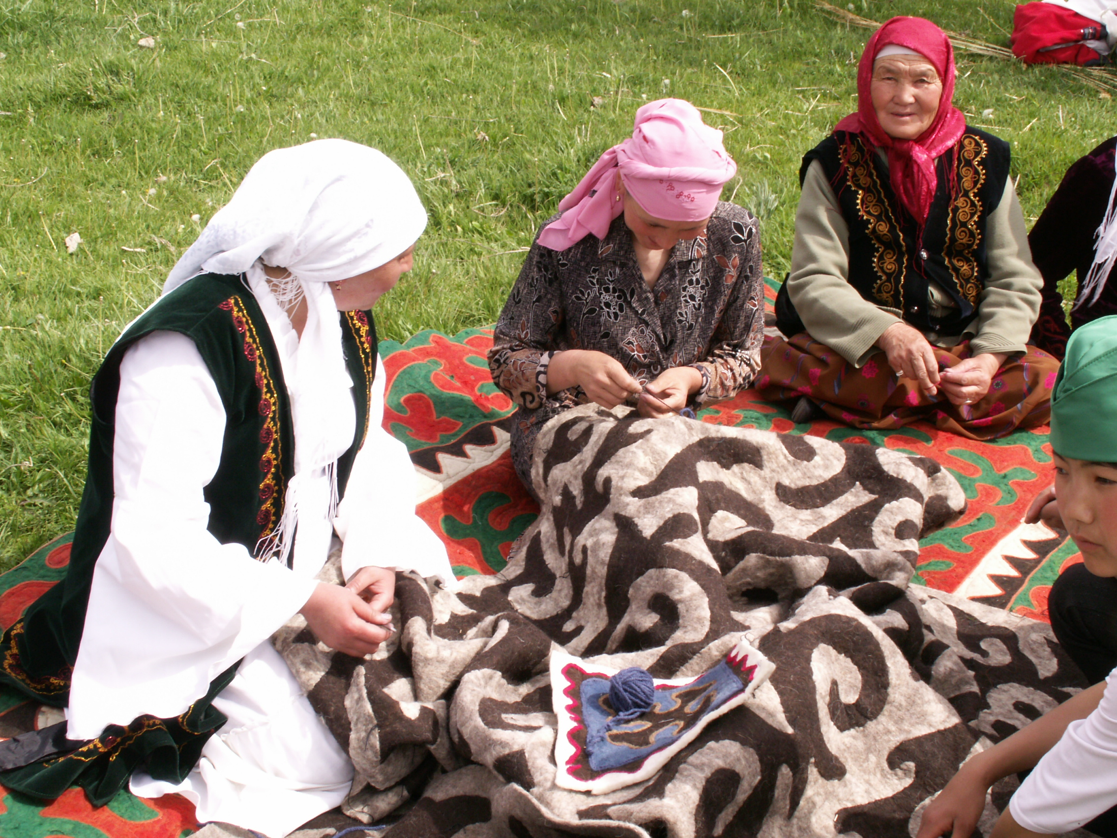
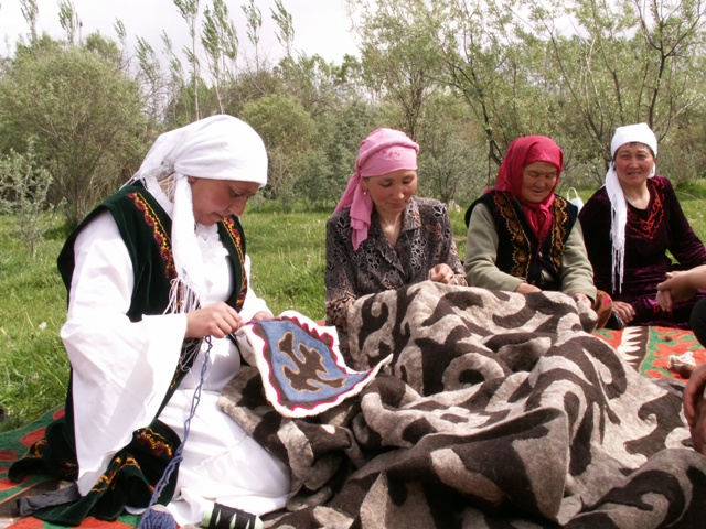
Visiting felt handicraft museum-shop, participating in national felt rug production.
Transfer to Karakol Town.
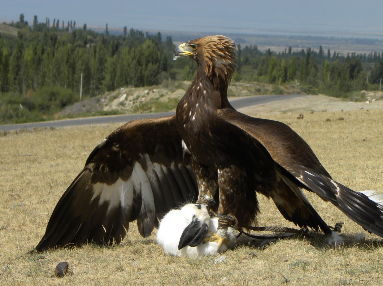
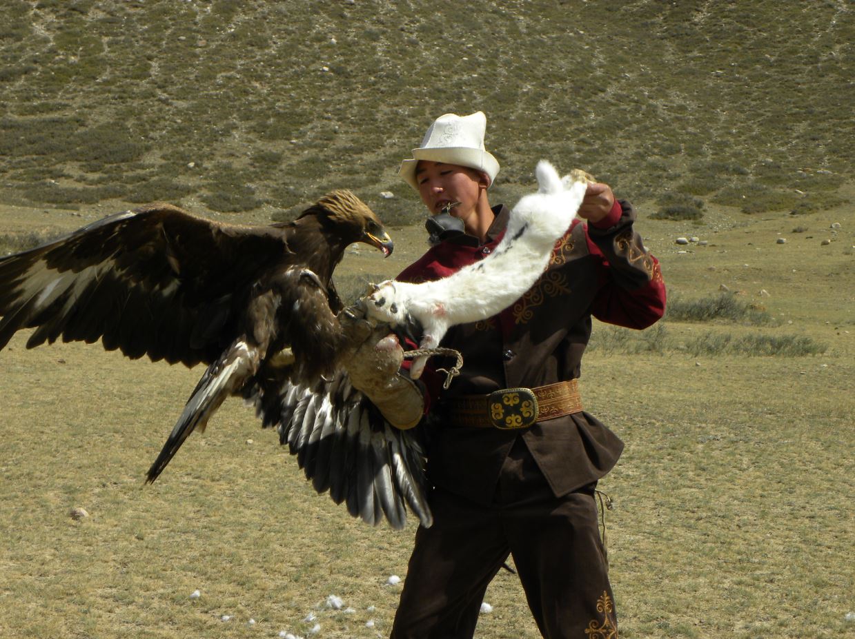
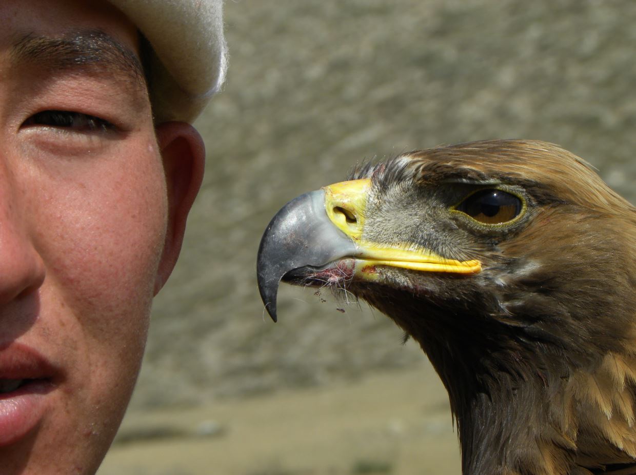
In Toktogul Village demonstration of eagle hinting.
Visiting Fairy-tale Gorge, some walking.
The Fairy Tale Canyon / Skazka Canyon
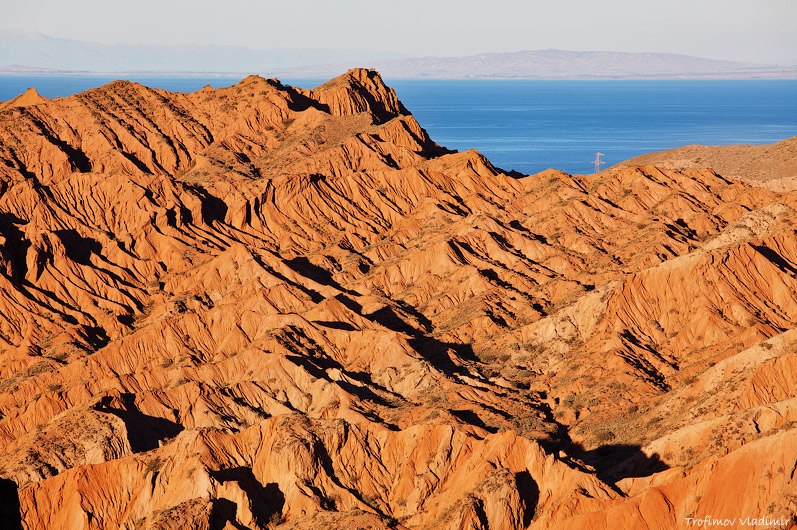
The canyon was named because of its bizarre rocky landscape, which for many years has been transformed by wind into amazing sculptures and formations. Some formations look like The Great Wall of China and you can also find other formations that look like snakes, dragons, sleeping giants and even whole castles. From here opens unusual view on a majestic panorama of lake and blue caps of mountains. It’s an excellent destination for children and adults alike and makes for an easy hike close to the lake.
Lunch picnic at the shore of the lake.
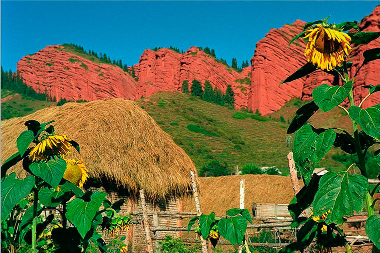
Visiting Jety-Ogyz Gorge
Jeti-Oguz is famous for its large, red sedimentary rocks, about 2,200m. The rock have been carved out by a river from the Terskey Alatoo mountains. Years of weathering have split the rocks into seven parts. The forms of the rocks are similar to the head of the seven bulls, “Jeti”-means seven and “Oguz”-means bull in Kyrgyz. Another beautiful place to see is Broken Heart. This is a reddish rock shaped like a broken heart. For this rock, there are several legends: long ago a king who was very rich and had many wives went hunting. One day he saw a beautiful girl with black long hair. He fall in love with her at first sight, and wanted to marry her. However she was from a poor family and was already engaged. Her family ran away from the king when they learned that he wanted their daughter. But the king caught them, killed her fiancé and her family. Her heart was torn by sadness and the Broken Heart appeared in that place.
Accommodation at the hotel in Karakol Town. Dinner.
Day 6. Karakol Town – Altyn Arashan Gorge – Karakol
After breakfast transfer to Altyn-Arashan Gorge.
Altyn Arashan (Golden Spa) is a valley and mountain resort near Karakol and Issyk Kul Lake, northeastern Kyrgyzstan. It lies along a trekking route from Teploklyuchenka (Ak-Suu). It is a hot spring development set in an alpine valley, containing the 4260 metre Pik Palatka in its southern part. It is said to "include three groups of nitric thermals springs on the right side of the Arashan River, 20 km southeast of Karakol mountain, situated in a picturesque forest landscape at an altitude of 2350-2435 metres." The resort has numerous wooden sheds which contain hot sulfurous pools to cure various ailments. The resort is set in a botanical research area called the Arashan State Nature Reserve which has about 20 snow leopards and a several bears.
Walking in the gorge, taking bath in the hot spring water. Picnic lunch.
In the afternoon transfer to Karakol Town.
Dinner with Kyrgyz Folk show in dungan family.
Accommodation at the hotel.
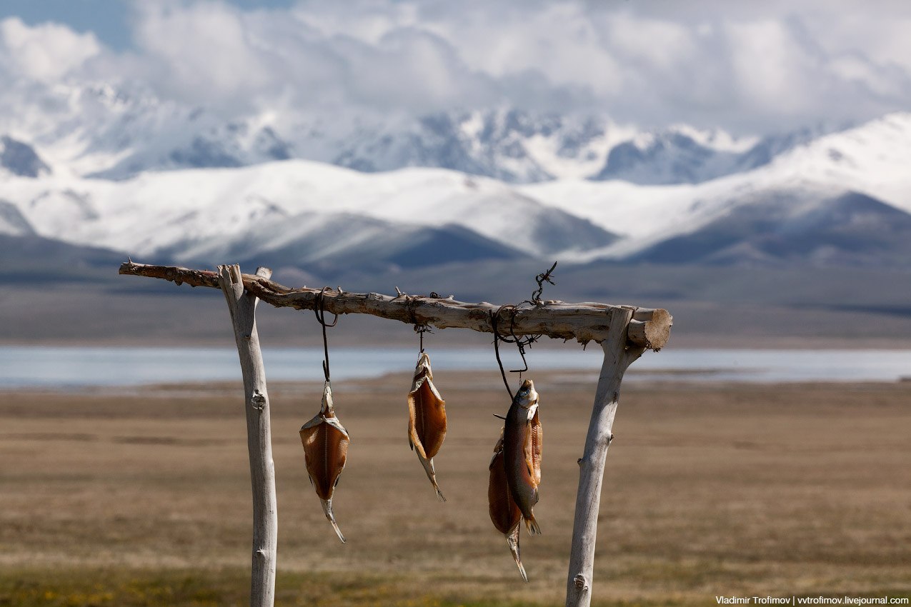
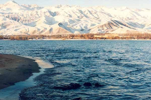
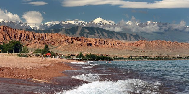
Day 7. Karakol Town – Issyk-Kul Lake
After breakfast city tour than transfer to Issyk-Kul Lake.
En the route visiting Przhevalsky’s cultural complex.
City tour including visiting Dungan mosque, Orthodox Church, antique shop.
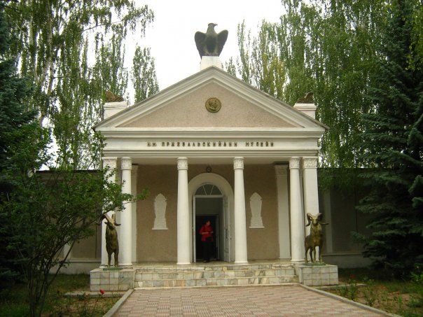
Prjevalski Museum
Nikolay Mikhailovich Przhevalsky is one of the first Russian Scientist-Geographer who started studying in details the geography, flora and fauna of the Central Asian countries. Beginning from 1870, he arranged 4 large expeditions to Mongolia, China and the Tibet. During his expeditions he revealed the exact directions of the mountain ranges and borders of the Tibet Mountains. He described the nature, relief, climate, flora and fauna in the territories under his study and discovered over 200 plant species. Przhevalsky also collected an enormous zoological collection which comprised several thousand of species of plant, animals, birds, fishes and insects. In the year of 1888, he died from typhoid fever on the eve of his fifth expedition to Central Asia; he was buried on the Issyk-Kul lakeside not far from the city of Karakol. The Memorial Museum of N. M. Przhevalsky was opened on 29 April 1957 in Karakol.
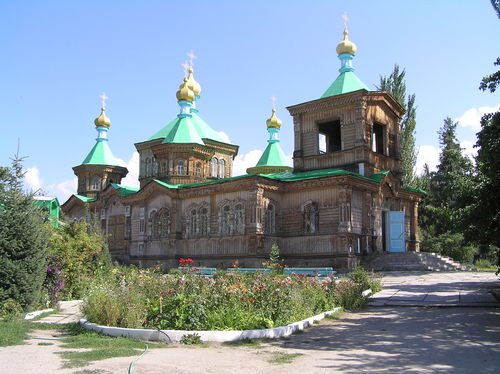
Orthodox Church
The story of the church goes back to July, 1869, when Karakol was basically a garrison town established as an outpost on the edges of the Tsarist Russian Empire. The Karakol Church, however, was destroyed in an earthquake in 1889 which caused havoc in the town and took several lives. It took six years to complete, and was finally consecrated in 1895. During the period of construction, a yurt served the congregation as a church. It has seen considerable service, not just as a church. Over the years, particularly following the Revolution in 1917, it has been used as an educational center housing a school, ladies’ gymnasium and an institution of Higher Education; a Sports Hall; a Theater; a Dance Hall and even as a Coal Store. Then, in 1991, following the collapse of the Soviet Union and the Independence of Kyrgyzstan, the local authority once again gave the building back to the church, with the proviso that all further restorations were their responsibility.
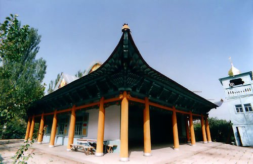
Dungan Mosque
Issyk-kul Central Mosque of Karakol city named after Ibrahim Aji was built by initiative of Ibrahim Aji. His given name is Ma - Yoo - Ton. He invited the famous Beijing architect Chou Seu and 20 carvers with the skills of traditional Chinese architecture and composition techniques for building the mosque. In the construction of outbuildings and other work were involved local craftsmen. Construction of the mosque began in 1904 and completed in 1907. Ingenious system allows builders to build the mosque with no metal reinforcement tools. The mosque holds 42 based pillars. Encircling of the building is multi-tiered wooden cornice, decorated with images of plants like grapes, pomegranates, pears and peaches. From 1929 to 1947 during the Soviet era mosque was used as a storehouse. In 1947, the building was given to the Muslim community and to the present day function as a mosque. Besides it the mosque is registered as a historical monument and protected by the law. Today mosque operates successfully and opens for everyone who visits our city.
Accommodation at the hotel on the shore of the lake.
Lunch at the hotel. Relax time for swimming and s.o.
Dinner at the hotel.
Day 8. Issyk-Kul Lake - Bishkek
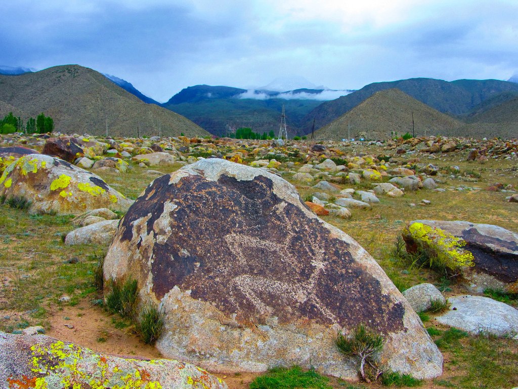
Transfer to Bishkek. Visiting an open gallery of petroglyphs in Cholpon-Ata Town.
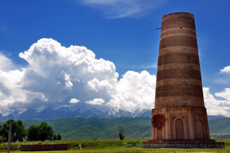
En the route excursion to the 11th century Burana historical complex.

The Burana Tower is a large minaret in the Chuy Valley in northern Kyrgyzstan. It is located about 80 km east of the country's capital Bishkek, near the town of Tokmok. The tower, along with grave markers, some earthworks and the remnants of a castle and three mausoleums, is all that remains of the ancient city of Balasagun,which was established by the Karakhanids at the end of the 9th century. An external staircase and steep, winding stairway inside the tower enables visitors to climb to the top.The tower was originally 45 m (148 ft) high. However, over the centuries a number of earthquakes caused significant damage to the structure. The last major earthquake in the 15th century destroyed the top half of the tower, reducing it to its current height of 25m (82 ft). In the early 1900s, Russian immigrants to the area used some of the bricks from the tower for new building projects.A renovation project was carried out in the 1970s to restore its foundation and repair the west-facing side of the tower, which was in danger of collapse.
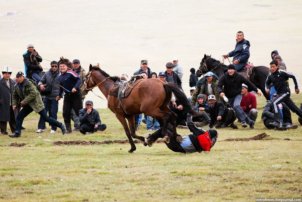
Demonstration of horse game show.
Lunch.
Accommodation at the hotel in Bishkek. Dinner.
Day 9. Bishkek
Transfer to the airport. Departure.
It’s possible to change the program according to your wish…